
 Continue with onX Maps
 Continue with Facebook


 Intermediate

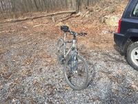
“A hard-to-follow trace that starts easy before increasing in difficulty due to rocky sections along the ridge. ”


1.7
Miles2.8
KMSingletrack
 Intermediate
Land Manager: PA DCNR - Michaux State Forest
 The Emmitsburg Multi User Trail Tour
7.2 mi 11.6 km • 1,037' Up 316.01 m Up • 1,037' Down 315.97 m Down

 Emmitsburg New Beginner Loops
2.6 mi 4.1 km • 133' Up 40.39 m Up • 133' Down 40.47 m Down
 Emmitsburg, MD
Canada Hollow Gumrun Loop
Emmitsburg, MD
Canada Hollow Gumrun Loop
6.4 mi 10.2 km • 765' Up 233.07 m Up • 765' Down 233.07 m Down
 Gambrill State Park Yellow Loop Figure 8
7.3 mi 11.7 km • 768' Up 234.03 m Up • 782' Down 238.36 m Down
Braddoc…, MD
Twisted Furnace Ride
19.3 mi 31.1 km • 2,166' Up 660.31 m Up • 2,166' Down 660.31 m Down


0 Comments