
 Continue with onX Maps
 Continue with Facebook


 Easy
Easy

“85 miles of fresh air and wide open spaces. Get free from the congestion of other trails. ”


84.7
Miles136.3
KMDoubletrack
 Easy
Easy
Local Club: SABA Dirt Riders
Land Manager: Lassen Land and Trails Trust
 Modoc Line Rail Trail - Sage Hen
22.0 mi 35.3 km • 224' Up 68.19 m Up • 1,137' Down 346.56 m Down
 Modoc Line Rail Trail - Snowstorm Canyon Segment
17.0 mi 27.3 km • 954' Up 290.72 m Up • 15' Down 4.49 m Down
 South Side Trail
7.2 mi 11.6 km • 883' Up 269.09 m Up • 525' Down 160.13 m Down
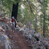
 Susanville, CA
Lassen Creek Conservation Area Trail
Susanville, CA
Lassen Creek Conservation Area Trail
1.8 mi 3.0 km • 236' Up 72.03 m Up • 128' Down 38.99 m Down
Earn a Diamond Mt. Ring
30.0 mi 48.3 km • 3,752' Up 1143.67 m Up • 3,754' Down 1144.17 m Down
Bizz Johnson National Recreation Trail
26.3 mi 42.4 km • 295' Up 89.82 m Up • 1,349' Down 411.24 m Down


0 Comments