
 Continue with onX Maps
 Continue with Facebook


 Intermediate


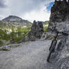
“A connecting trail segment in the valley between the Davos-Laret and Davos-Wolfgang stations. ”


1.7
Miles2.8
KMDoubletrack
 Intermediate
 Rinerhorn #647
26.0 mi 41.9 km • 3,030' Up 923.66 m Up • 3,030' Down 923.56 m Down
Davos, CH
Chörbschhorn #646
11.9 mi 19.1 km • 999' Up 304.5 m Up • 4,663' Down 1421.34 m Down
 Davos, CH
 Parsenn #332
16.6 mi 26.7 km • 613' Up 186.76 m Up • 4,201' Down 1280.52 m Down
Davos, CH
Durannapass #631
26.4 mi 42.5 km • 3,866' Up 1178.47 m Up • 7,455' Down 2272.32 m Down
Davos, CH
Scaletta Pass Keschhütte Roundtrip
46.4 mi 74.6 km • 9,194' Up 2802.32 m Up • 9,311' Down 2838.09 m Down
Alps Trail Davos - IMBA EPIC
25.8 mi 41.5 km • 2,891' Up 881.3 m Up • 7,800' Down 2377.45 m Down
Davos, CH


0 Comments