MTB Project Logo

An easygoing climb up to Comb Ridge.


Your Rating: Rating Rating Rating Rating Rating      Clear Rating
Your Difficulty:
Your Favorites: Add To-Do · Your List
Zoom in to see details
Map Key

5.2

Miles

8.4

KM

Doubletrack

5,893' 1,796 m

High

4,861' 1,482 m

Low

1,032' 315 m

Up

3' 1 m

Down

4%

Avg Grade (2°)

18%

Max Grade (10°)

Dogs Unknown

E-Bikes Unknown

Please Respect and Protect archaeological sites: Stay on trail, help prevent damage. Don’t move artifacts, let everyone enjoy the discovery. Stay out of ancient buildings and off walls, they are fragile! Report looting and vandalism: 1 800 722 3998

Description

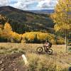
Starting off of Utah 95, this road provides a mellow and peaceful climb. Two wash crossings along the way are usually dry, though if there has been rain, it’s possible that you’ll encounter a sizable stream with fast-moving water.

Beyond the river crossing, stay right and enjoy pedaling up the road, which follows the side of the rock wall. The road becomes much rougher here, but is never too technical and stays full-width for the entire climb.

The views from the final switchback are stunning. Near the summit, the road has been directly cut into the mountain, which gives it a unique feel. The view from the top is a great spot to head back from. Otherwise, the road continues a bit farther to intersect with County Rd 228 and the hiker-only Posey's Trail.

Contacts

Shared By:

Joel Gratz

Trail Ratings

  4.0 from 2 votes

#12958

Overall
  4.0 from 2 votes
5 Star
50%
4 Star
0%
3 Star
50%
2 Star
0%
1 Star
0%
Trail Rankings

#534

in Utah

#12,958

Overall
10 Views Last Month
1,341 Since Oct 24, 2016
Intermediate Intermediate

0%
0%
100%
0%
0%
0%

Photos

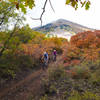
Heading toward the climb along Comb Wash Road.
Oct 24, 2016 near Blanding, UT

0 Comments

Weather


Current Trail Conditions

Unknown
Add Your Check-In

Check-Ins

none
Welcome

Join the Community

Create your FREE account today!
Already have an account? Login to close this notice.

Get Started