
 Continue with onX Maps
 Continue with Facebook


 Intermediate/Difficult


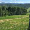
“A fast descent through the aspens. ”


2.8
Miles4.6
KMSingletrack


0 Comments