
 Continue with onX Maps
 Continue with Facebook


 Intermediate/Difficult

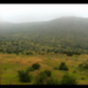
“A rough, rocky climb, or technical downhill as gliders cycle overhead. ”


0.7
Miles1.1
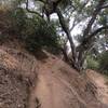
KMSingletrack
 Intermediate/Difficult
Land Manager: City of San Diego - Parks & Recreation
 Horned Lizzard to Whiptail Loop
5.4 mi 8.7 km • 730' Up 222.39 m Up • 729' Down 222.31 m Down
 La Costa Preserve - South Side Access
8.8 mi 14.1 km • 1,216' Up 370.54 m Up • 1,216' Down 370.49 m Down
 Classic E-Ticket Route
5.4 mi 8.7 km • 593' Up 180.76 m Up • 591' Down 180.28 m Down
Parking lot to E-Ticket and Back
4.6 mi 7.5 km • 530' Up 161.56 m Up • 559' Down 170.44 m Down
 Santee, CA
San Clemente Canyon
Santee, CA
San Clemente Canyon
9.8 mi 15.7 km • 311' Up 94.93 m Up • 327' Down 99.67 m Down
 Cowles Mtn
5.4 mi 8.6 km • 1,211' Up 369.03 m Up • 1,224' Down 373.02 m Down


1 Comment