
 Continue with onX Maps
 Continue with Facebook


 Difficult


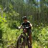
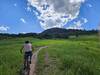
“An initial uphill climb leads to broad views of the valley followed by more climbs and descents. ”


3.2
Miles5.1
KMDoubletrack
 Difficult
Local Club: Hardscrabble Trails Coalition
Land Manager: BLM Colorado - Colorado River Valley Field Office
 Abrams Loop
8.4 mi 13.5 km • 1,285' Up 391.66 m Up • 1,285' Down 391.75 m Down
Eagle Hardscrabble Trails Tour
19.4 mi 31.2 km • 3,060' Up 932.61 m Up • 3,060' Down 932.61 m Down
 Beaver Creek > Cinch > Corkscrew > Aspen Glade
8.0 mi 12.8 km • 1,843' Up 561.81 m Up • 1,844' Down 561.92 m Down
Wild Ridge Sample
5.1 mi 8.2 km • 979' Up 298.55 m Up • 978' Down 298.13 m Down
Avon, CO
Lower Grouse Creek
6.1 mi 9.9 km • 1,140' Up 347.38 m Up • 1,140' Down 347.57 m Down
Meadow Mountain Loop
10.3 mi 16.6 km • 2,088' Up 636.43 m Up • 2,088' Down 636.36 m Down
Minturn, CO


0 Comments