
 Continue with onX Maps
 Continue with Facebook


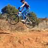
 Easy/Intermediate

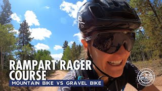
“A dirt road with a steady but challenging climb, with awesome vistas over Colorado Springs. ”


57.3
Miles92.1
KMSingletrack
 Easy/Intermediate
Land Manager: USFS - Pike & San Isabel National Forests Office
 LPC After Work Ride
5.3 mi 8.5 km • 686' Up 209.09 m Up • 686' Down 209.23 m Down

 Red Rock Canyon Tour
7.5 mi 12.1 km • 861' Up 262.45 m Up • 859' Down 261.79 m Down
Roundup Trail Loop at Red Rock Canyon Open Space
3.5 mi 5.7 km • 432' Up 131.55 m Up • 439' Down 133.83 m Down
D-Loop #1.2
14.5 mi 23.4 km • 1,844' Up 562.2 m Up • 1,838' Down 560.21 m Down
Manitou…, CO
D-Loop #3
16.4 mi 26.4 km • 2,892' Up 881.61 m Up • 2,899' Down 883.6 m Down
Ute Valley Six Mile Loop
5.8 mi 9.3 km • 578' Up 176.04 m Up • 579' Down 176.35 m Down
 Colorad…, CO


 All Clear


3 Comments