
 Continue with onX Maps
 Continue with Facebook


 Intermediate

“A multi-use trail with some roots, few rocks, and little elevation changes. ”


6.0
Miles9.7
KMSingletrack
 Intermediate
Local Club: Upstate SORBA
Land Manager: Clemson Experimental Forest Operations
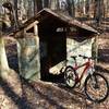
 The Bottom End
21.9 mi 35.3 km • 2,281' Up 695.2 m Up • 2,283' Down 695.85 m Down


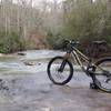
 Waterfall Area
5.0 mi 8.0 km • 450' Up 137.18 m Up • 452' Down 137.76 m Down
Tour of Issaqueena
10.3 mi 16.6 km • 1,131' Up 344.76 m Up • 1,130' Down 344.37 m Down
20 Miles of Northern Issaqueena
19.6 mi 31.6 km • 2,113' Up 643.94 m Up • 2,114' Down 644.4 m Down
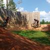
Town Creek Bike Park
0.8 mi 1.3 km • 29' Up 8.75 m Up • 29' Down 8.76 m Down
 Paris Mountain State Park
11.5 mi 18.6 km • 1,338' Up 407.71 m Up • 1,337' Down 407.56 m Down
Wade Ha…, SC


0 Comments