
 Continue with onX Maps
 Continue with Facebook


 Difficult

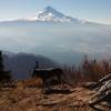
“An access trail to Clear Lake through nice forest. ”


3.8
Miles6.1
KMSingletrack
 Difficult
Local Club: Hood River Area Trail Stewards
Feb 14, 2024: Get your HR parking permits here…
Jan 1, 2024: End of Year Donation Request
Dec 18, 2023: 5 Tips for riding Post Canyon…
Land Manager: USFS - Mt. Hood National Forest Office
 Timberline to Rhododendron
15.7 mi 25.2 km • 202' Up 61.68 m Up • 4,387' Down 1337.18 m Down

 Governm…, OR
 Gunsight Ridge
18.7 mi 30.1 km • 2,550' Up 777.24 m Up • 2,548' Down 776.68 m Down
Governm…, OR
 Boulder Lake Loop
17.9 mi 28.8 km • 2,676' Up 815.57 m Up • 2,674' Down 815.08 m Down
Fifteen Mile Loop
11.1 mi 17.8 km • 2,063' Up 628.76 m Up • 2,065' Down 629.52 m Down
Governm…, OR
Sandy Ridge Full Tour
15.7 mi 25.2 km • 2,687' Up 819.06 m Up • 2,686' Down 818.84 m Down
Mount H…, OR
Surveyor's Ridge - NF 17 Loop
23.4 mi 37.6 km • 2,440' Up 743.82 m Up • 2,423' Down 738.41 m Down
Odell, OR


1 Comment