MTB Project Logo

An intermediate loop trail that follows the creek.


Your Rating: Rating Rating Rating Rating Rating      Clear Rating
Your Difficulty:
Your Favorites: Add To-Do · Your List
Zoom in to see details
Map Key

2.1

Miles

3.4

KM

Singletrack

1,011' 308 m

High

818' 249 m

Low

75' 23 m

Up

251' 77 m

Down

3%

Avg Grade (2°)

17%

Max Grade (10°)

Dogs Leashed

E-Bikes Unknown

Description

The Dogwood Loop can be accessed from the campground or down at the bottom of the trail system, near the picnic area parking. You'll want to take the Camping Access Road to the start of this trail, and you'll be close to the Salamander Trail.

Ride your bicycle towards the turn around, parallel and along the creek and you'll find the beginning of the trail. From there, this trail follows the creek for about 1.5 miles and then starts climbing up into the woods with a few medium climbs. The very start along the creek is rocky and technical for about 90 yards. The rest of the route is easy until it heads up into woods. Due to a few climbs, this one is rated intermediate, though you won't have to overcome too many obstacles.

If you ride the Dogwood Loop starting from campgrounds, start on the Dogwood Trail headed south. The trailhead can be found by taking the left fork in the campground, then 40 yards down you'll see the Dogwood Trail trailhead on your right. There are two steep sections of the trail right after the campground. Riding the Dogwood Loop in an counter-clockwise direction makes the trail a little faster because it's mostly downhill until you reach the elevation of the creek. This is the suggested direction to ride the Dogwood Loop. Riding counterclockwise can also happen after climbing to the end of the Upper Salamander Trail.

In approximately 5 places on the Dogwood Trail, natural springs keep the trail wet/muddy almost year round, especially so in spring and summer. A few of these locations are quite long in length. These muddy spots can cause braking/sliding issues when headed downhill and when going uphill can some muddy hike-a-bike situations.

Also, when Beaver Creek floods, the lower lying areas of the Dogwood Trail can be wet/muddy and could have fresh debris/branches/trees from the flooding. The lowest areas could be under water. This is mostly a concern in the spring.

Contacts

Shared By:

Scott Danish

Trail Ratings

  3.0 from 3 votes

#24632

Overall
  3.0 from 3 votes
5 Star
0%
4 Star
0%
3 Star
100%
2 Star
0%
1 Star
0%
Trail Rankings

#342

in Ohio

#24,632

Overall
2 Views Last Month
165 Since Jan 19, 2016
Intermediate Intermediate

0%
0%
100%
0%
0%
0%

Photos

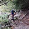
Lower section of Dogwood Trail along the creek.  This is very near the one trailhead down along Beaver Creek.  Many people hike/bike this section since it is so close to the creek and road.
Feb 7, 2016 near Glenmoor, OH
Another section on the lower side of Dogwood Trail along the creek.
Feb 7, 2016 near Glenmoor, OH

0 Comments

Weather


Current Trail Conditions

Bad / Closed 1 day ago
Add Your Check-In

Check-Ins

none

Stewarded By

Welcome

Join the Community

Create your FREE account today!
Already have an account? Login to close this notice.

Get Started