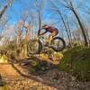
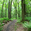
“A good singletrack option for a shuttle to the Lower Yough. ”
1.7
Miles2.7
KMSingletrack

Land Manager: PaDCNR - Ohiopyle State Park
 Ohiopyle Quickie
2.9 mi 4.7 km • 321' Up 97.97 m Up • 317' Down 96.55 m Down


 Ohiopyle, PA
 New Skool Shuttle Banger
10.5 mi 16.9 km • 336' Up 102.44 m Up • 1,885' Down 574.67 m Down


 Ohiopyle, PA
 Jones Mills to Laurel Highlands
44.4 mi 71.4 km • 2,986' Up 910 m Up • 2,987' Down 910.44 m Down


 Bear Rocks, PA
 Clockwise Quebec
11.3 mi 18.2 km • 1,669' Up 508.75 m Up • 1,673' Down 509.79 m Down


 Fairchance, PA
 Intro to Laurel
14.3 mi 23.0 km • 545' Up 166.21 m Up • 545' Down 166.12 m Down


 Boswell, PA
 West Run Woods Full Loop
1.9 mi 3.1 km • 261' Up 79.54 m Up • 294' Down 89.69 m Down


 Star City, WV


0 Comments