MTB Project Logo

A challenging, remote singletrack loop.


Your Rating: Rating Rating Rating Rating Rating      Clear Rating
Your Difficulty:
Your Favorites: Add To-Do · Your List
Zoom in to see details
Map Key

23.9

Miles

38.4

KM

60%

Singletrack

8,461' 2,579 m

High

6,477' 1,974 m

Low

4,559' 1,390 m

Up

4,559' 1,390 m

Down

7%

Avg Grade (4°)

35%

Max Grade (19°)

Dogs Unknown

E-Bikes Unknown

Overview

A solid backcountry day in the saddle with lots of climbing rewarded with ripping descents.
The trail starts with the comparatively well-traveled South Fork of Horseshoe Canyon trail, and adds on a loop with South Canyon Creek and then North Canyon Creek trails.

Need to Know

The trail gets pretty far out there, and I got the feeling that not too many people ride this route. Go prepared; you are a long way from help if things go wrong.

Description

Climb South Fork of Horseshoe Canyon to the intersection with the rerouted Mahogany Creek trail (marked with a brake rotor on a tree). Take a right and climb briefly; descend into a saddle and then hike-a-bike up a steep, loose slope to another intersection with North Canyon Creek Trail. Pass the turn off to North Canyon Creek and continue to Elk Flats (a large, open meadow) and hang a right on South Canyon Creek trail.
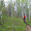
Descend the South Canyon Creek drainage for six miles of ripping, narrow moto trail punctuated with some small steep climbs and creek crossings.

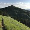
At the bottom of the drainage, take a sharp right (marked by a 50 gallon drum) and climb the (mostly) very rideable North Canyon Creek up a drainage parallel to the one you just came down.There will probably be some hiking near the top on loose, rutted moto trail. Stay right at all of the three forks that you encounter. After the second fork you get some great descending through open meadows above treeline. The left option on the last of the three forks is a short fall-line, hike-a-bike to a beautiful view of the Tetons and is a worthwhile out and back.

You'll eventually descend back to the intersection with South Fork of Horseshoe Canyon and Mahogany Creek. Descend either South Fork of Horseshoe Canyon back to where you started, or Mahogany Creek and ride some road back to the start. Better yet, shuttle a car to the bottom of Mahogany Creek. Both are fast, extremely fun descents.

Contacts

Shared By:

Zach Allen

Trail Ratings

  3.7 from 3 votes

#3289

Overall
  3.7 from 3 votes
5 Star
0%
4 Star
67%
3 Star
33%
2 Star
0%
1 Star
0%
Recommended Route Rankings

#118

in Idaho

#3,289

Overall
3 Views Last Month
2,764 Since Aug 25, 2015
Difficult Difficult

0%
0%
0%
0%
100%
0%

Photos

Best spot on this trail of the Tetons.
Aug 12, 2014 near Driggs, ID

0 Comments

Weather


Current Trail Conditions

Unknown
Add Your Check-In

Check-Ins

none
Welcome

Join the Community

Create your FREE account today!
Already have an account? Login to close this notice.

Get Started