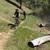
“Climb into the Granite Spires, then descend endlessly. ”
11.2
Miles18.1
KMSingletrack

Local Club: Southwest Idaho Mountain Bike Association
Land Manager: USFS - Boise National Forest Office
 Peace Creek Loop
35.1 mi 56.4 km • 5,065' Up 1543.82 m Up • 5,052' Down 1539.94 m Down


 Cascade, ID
 Rocket Trail Loop
2.4 mi 3.8 km • 385' Up 117.22 m Up • 383' Down 116.65 m Down


 Cascade, ID
 Idaho Trail Segment 9
64.9 mi 104.4 km • 5,683' Up 1732.18 m Up • 5,420' Down 1652.12 m Down


 Challis, ID
 Airline Loop
22.1 mi 35.6 km • 3,251' Up 990.84 m Up • 3,246' Down 989.27 m Down


 Idaho City, ID
 Granite - Smith Traverse
21.9 mi 35.3 km • 3,610' Up 1100.39 m Up • 3,707' Down 1129.79 m Down


 Idaho City, ID
 Schoolhouse Gulch Loop
1.9 mi 3.1 km • 257' Up 78.3 m Up • 256' Down 78.1 m Down


 Idaho City, ID


1 Comment