
 Continue with onX Maps
 Continue with Facebook


 Intermediate


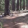
“Access to the south end of Mendocino National Forest via M5, a mellow doubletrack. ”


6.1
Miles9.8
KMDoubletrack
 Intermediate
Land Manager: USFS - Mendocino National Forest Office
 Boggs Forest Intermediate Loop
10.4 mi 16.8 km • 1,261' Up 384.46 m Up • 1,267' Down 386.29 m Down

 High Bridge Upper Loop
16.9 mi 27.2 km • 2,496' Up 760.84 m Up • 2,497' Down 760.94 m Down
Fiske to Foley Creek to Long Canyon
27.3 mi 43.9 km • 4,262' Up 1298.97 m Up • 4,266' Down 1300.4 m Down
Fiske Creek Loop
17.2 mi 27.7 km • 2,870' Up 874.81 m Up • 2,870' Down 874.78 m Down
Fiske Peak Loop
16.7 mi 26.8 km • 3,349' Up 1020.73 m Up • 3,356' Down 1022.96 m Down
 Long Canyon Loop
9.0 mi 14.5 km • 1,304' Up 397.4 m Up • 1,304' Down 397.61 m Down


0 Comments