
 Continue with onX Maps
 Continue with Facebook


 Difficult


 Difficult
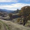
 Long Canyon Loop
9.0 mi 14.5 km • 1,304' Up 397.4 m Up • 1,304' Down 397.61 m Down
 Fiske to Foley Creek to Long Canyon
27.3 mi 43.9 km • 4,262' Up 1298.97 m Up • 4,266' Down 1300.4 m Down
Double Loop
18.1 mi 29.1 km • 2,892' Up 881.4 m Up • 2,889' Down 880.69 m Down
Las Posadas Forest - Short Loop
3.5 mi 5.6 km • 472' Up 143.91 m Up • 472' Down 143.75 m Down
Angwin, CA
Trione-Annadel State Park - Big Loop
16.7 mi 26.9 km • 1,830' Up 557.88 m Up • 1,839' Down 560.5 m Down
Santa Rosa, CA
 Annadel Loop Alternative
7.9 mi 12.6 km • 625' Up 190.6 m Up • 628' Down 191.36 m Down


0 Comments