
 Continue with onX Maps
 Continue with Facebook


 Difficult

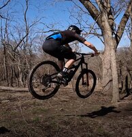
“A challenging and picturesque creek side trail. ”


0.9
Miles1.5
KMSingletrack
 Difficult
Land Manager: Big Bear Lake, WV
 Fork Run Trails
7.5 mi 12.1 km • 926' Up 282.22 m Up • 927' Down 282.66 m Down

 Oakland, MD
Cooper's Rock Enduro Course
Oakland, MD
Cooper's Rock Enduro Course
10.8 mi 17.4 km • 1,110' Up 338.3 m Up • 2,368' Down 721.86 m Down
Cheat Lake, WV
 New Skool Shuttle Banger
10.5 mi 16.9 km • 336' Up 102.44 m Up • 1,885' Down 574.67 m Down
Ohiopyle, PA
 Ohiopyle Shuttle Ride - Summit to Town
11.6 mi 18.7 km • 708' Up 215.86 m Up • 2,245' Down 684.41 m Down
White Park
3.4 mi 5.4 km • 205' Up 62.63 m Up • 214' Down 65.23 m Down
Baker's Ridge Clockwise Loop
2.6 mi 4.2 km • 314' Up 95.67 m Up • 281' Down 85.63 m Down


0 Comments