
 Continue with onX Maps
 Continue with Facebook


 Intermediate

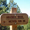
“Fire road that heads southwest from Waterline Road (Trail). ”


1.1
Miles1.7
KMDoubletrack
 Intermediate
Local Club: Flagstaff Biking Organization
Dec 19, 2023: 2023 Trail Program wrap up
Oct 24, 2023: Cambium Wealth & Legacy Strategies Sponsorship
Oct 9, 2023: URGENT PUBLIC MEETING! Butler/4th Street Improvements Project
Land Manager: USFS - Coconino National Forest Office
 Schultz Pass Loop
11.5 mi 18.6 km • 926' Up 282.27 m Up • 931' Down 283.67 m Down

 Flagstaff, AZ
 High Country Tour to Bismark Lake
17.5 mi 28.2 km • 1,774' Up 540.67 m Up • 1,774' Down 540.79 m Down
Flagstaff, AZ
 Schultz Creek 8 Ball
21.6 mi 34.8 km • 1,870' Up 569.86 m Up • 1,870' Down 569.85 m Down
Fisher Point
12.1 mi 19.4 km • 934' Up 284.68 m Up • 933' Down 284.47 m Down
Soldier's Jalapeno
8.3 mi 13.3 km • 595' Up 181.21 m Up • 595' Down 181.38 m Down
Sycamore Rim
10.9 mi 17.6 km • 1,129' Up 344.23 m Up • 1,128' Down 343.68 m Down


0 Comments