
 Continue with onX Maps
 Continue with Facebook


 Intermediate
Intermediate
Intermediate
 Intermediate
Local Club: Concerned Off-Road Bicyclists Association - CORBA
Land Manager: USFS - Angeles National Forest Office
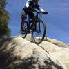
 Glendale Sports Complex - Cherry Canyon Loop
8.8 mi 14.2 km • 1,381' Up 420.81 m Up • 1,380' Down 420.61 m Down

 La Caña…, CA
 Eaton Saddle Downhill Shuttle
13.8 mi 22.2 km • 768' Up 234.15 m Up • 4,747' Down 1446.75 m Down
Altadena, CA
 Stough Canyon
8.8 mi 14.2 km • 1,829' Up 557.5 m Up • 1,828' Down 557.26 m Down
Hog Farm to Rattlesnake
6.5 mi 10.4 km • 870' Up 265.25 m Up • 868' Down 264.7 m Down
Chilao Figure-8 Loop
15.2 mi 24.5 km • 2,250' Up 685.74 m Up • 2,248' Down 685.34 m Down
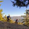
Mt. Wilson Enduro Loop
32.5 mi 52.3 km • 6,479' Up 1974.7 m Up • 6,487' Down 1977.37 m Down
Monrovia, CA


 All Clear


6 Comments