This description is for the OHV segment of Indiana Creek Road only. The road has been designated FDR 593 by the Forest Service and all field markings reference the trail number rather than the name.
Indiana Creek Road (OHV) begins just east of the trap shooting range in the Spruce Valley Ranch Subdivision, south of Breckenridge.
From town go south on Highway 9. The third left turn after the light at
Boreas Pass Road is Wagon Road. Go east (left) on Wagon Road for 0.3 miles to Indiana Creek Road. Go left and climb up the road, bearing left at the intersection with Spruce Valley Drive. 0.3 miles past Spruce Valley Drive pass the
Blue River Trail and in another 0.7 miles, pass through a gate at the end of a cul de sac. There is a horse stable on the left. In another 0.5 mile there is another cul de sac and the pavement ends. Continue east onto the dirt road and climb to the trap range and the beginning of the designated OHV route. The parking at the range is private, but there is room just east of the range to leave a car alongside the road.
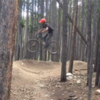
Begin climbing east, up valley. There is a trail-braid singletrack paralleling the initial segment of road. The singletrack descends back to the road and a confusing set of intersections. Follow the portion of doubletrack on the right with a stream running down it. There is a singletrack winding through the willows on the left side of the doubletrack.
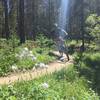
Take a left after emerging from the wetlands to a fork with FDR 611.3A (aka The Grind). Go left at the fork across the meadow on doubletrack passing a second fork on the right (a loop back to FDR 611.3A).
Once the trail leaves the meadow it climbs a bit more steeply with intermittent stingers 1.5 miles to Boreas Pass. There is a trail (FDR 597) on the right 0.5 miles from
Boreas Pass Road leading to the Dyerville Townsite and Warrior's Mark Mine. Continue straight to
Boreas Pass Road. The last 1/4 mile below Boreas Pass is tough, so leave a little in the tank for the last push.
From
Boreas Pass Road, the trail can be linked to
Baker's Tank Trail to the west, or riders can continue east to the summit of Boreas Pass.

 Continue with onX Maps
 Continue with Facebook


 Intermediate


1 Comment