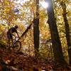
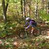
“The Back Trails marked with Blue arrows - more technical, tighter rocks, more up and down. ”
1.8
Miles2.9
KMSingletrack

Local Club: Forest Lea Trails Association
Jul 3, 2023: trail update
May 25, 2023: Bear sighting
May 10, 2023: trail conditions
Land Manager: County of Renfrew
 Unknown
 Original Route
5.8 mi 9.4 km • 186' Up 56.81 m Up • 189' Down 57.56 m Down


 Petawawa, ON
 Forest Lea Trails - Oliver's and Q loop
2.5 mi 4.0 km • 63' Up 19.24 m Up • 62' Down 18.96 m Down


 Petawawa, ON
 Alice to Achray from Forest Lea Trails
31.2 mi 50.2 km • 1,461' Up 445.39 m Up • 1,461' Down 445.27 m Down


 Petawawa, ON
 Canada Flag Overlook from Forest Lea Trails
33.2 mi 53.4 km • 1,866' Up 568.82 m Up • 1,871' Down 570.3 m Down


 Petawawa, ON


0 Comments