MTB Project Logo

An easy trail for beginners and a good warm up when connected to other trails.


Your Rating: Rating Rating Rating Rating Rating      Clear Rating
Your Difficulty:
Your Favorites: Add To-Do · Your List
Zoom in to see details
Map Key

2.7

Miles

4.3

KM

Singletrack

4,746' 1,447 m

High

4,608' 1,405 m

Low

138' 42 m

Up

47' 14 m

Down

1%

Avg Grade (1°)

3%

Max Grade (2°)

Dogs Unknown

E-Bikes Unknown

Heavily used by hikers, dog walkers, runners, equestrians, and moutain bikers. Any of the washes could be VERY fast flowing during the rainy season. During the summer, it can be very hot - bring water. Prepare to be exposed to the sun as well.

Description

This trail has several trailheads and possible choices. During the rainy season, any of the washes could be flowing VERY fast and wildlife is frequently seen in the area (coyote, javalina, bobcat, deer). This trail is heavily used by hikers, dog walkers and mountain bikers. This is an easy trail for kids to begin riding on.

Starting from the east:

BST and HWY 92 trailhead - from here, the trail heads south and crosses a culvert (a bridge is planned). Across the culvert,head south. This trail wends around, with some rocky points and minimal elevation gain. This trail can be a loop, or can go straight to the St. Andrews Drive trailhead.

St. Andrews trailhead - from here, you can head east (see above), or west. If you head west, cross the road and enter a drainage culvert for about 50 meters, the head west along the trail. There are a couple short steep sections. This trail goes to the next trailhead on Cherokee.

Cherokee trailhead - you can head east (see above) or west. If you head west, cross the street and find the steep beginning to the trail. This trail has a some short ups and downs and several twists. The slopes are generally gentle, there are a couple rocky and sandy points. There is a short trail to the south that leads to the Kachina Trailhead. The western most part of this trail connects to a trail that will lead to Brown Canyon.

Shared By:

David Finney

Trail Ratings

  2.0 from 1 vote

#35955

Overall
  2.0 from 1 vote
5 Star
0%
4 Star
0%
3 Star
0%
2 Star
100%
1 Star
0%
Trail Rankings

#1,133

in Arizona

#35,955

Overall
4 Views Last Month
1,515 Since Feb 22, 2014
Intermediate Intermediate

0%
0%
100%
0%
0%
0%

Photos

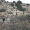
This is typical for Garden Canyon, a small rise, with some rocks in it, facing south-west.
Feb 23, 2014 near Sierra…, AZ
Garden Canyon Linear Park trail, looking west
Feb 23, 2014 near Sierra…, AZ
The Fort Huachuca Access corridor, looking towards Brown Canyon Ranch.
Feb 23, 2014 near Sierra…, AZ

0 Comments

Weather


Current Trail Conditions

All Clear 35 days ago
Add Your Check-In

Check-Ins

none
Welcome

Join the Community

Create your FREE account today!
Already have an account? Login to close this notice.

Get Started