
 Continue with onX Maps
 Continue with Facebook


 Intermediate/Difficult

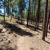
“Connection from one side of the highway to the other. ”


0.7
Miles1.2
KMSingletrack
 Intermediate/Difficult
Local Club: Verde Valley Cyclists Coalition
Land Manager: USFS - Coconino National Forest Office
 Llama Courthouse Vista Loop
5.7 mi 9.2 km • 380' Up 115.95 m Up • 381' Down 116.16 m Down

 Village…, AZ
Chuckwagon - Mescal - Long Canyon
Village…, AZ
Chuckwagon - Mescal - Long Canyon
9.1 mi 14.6 km • 805' Up 245.3 m Up • 791' Down 240.98 m Down
West Se…, AZ
 Fat Tire Loop
9.9 mi 15.9 km • 757' Up 230.67 m Up • 761' Down 231.99 m Down
West Se…, AZ
Get Choo Sum Side Oats!
10.7 mi 17.2 km • 726' Up 221.25 m Up • 725' Down 220.97 m Down
Soldier's Jalapeno
8.3 mi 13.3 km • 595' Up 181.21 m Up • 595' Down 181.38 m Down
Fisher Point
12.1 mi 19.4 km • 934' Up 284.68 m Up • 933' Down 284.47 m Down


 All Clear


0 Comments