
 Continue with onX Maps
 Continue with Facebook


 Intermediate

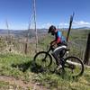
“A rolling trail originally made by motorcycles with plenty of climbing. ”


8.7
Miles14.1
KMSingletrack
 Intermediate
Local Club: Los Alamos Singletrack Association
Land Manager: USFS - Santa Fe National Forest Office
 Las Conchas-Los Griegos Traverse
27.2 mi 43.9 km • 3,852' Up 1173.96 m Up • 3,866' Down 1178.42 m Down

 Valles Caldera: NW Side
40.1 mi 64.6 km • 2,352' Up 716.97 m Up • 2,352' Down 716.89 m Down
 Half Aspen Loop around Pajarito Ski Area
5.0 mi 8.1 km • 1,195' Up 364.09 m Up • 1,195' Down 364.18 m Down
 NICA XC Course: Pedal Pajarito
3.2 mi 5.2 km • 550' Up 167.57 m Up • 545' Down 166.01 m Down
Los Alalmos Pipe Line Guaje
16.8 mi 27.1 km • 2,894' Up 882.04 m Up • 3,019' Down 920.09 m Down
White Ridge Trail System - Main Loop
8.4 mi 13.5 km • 831' Up 253.34 m Up • 825' Down 251.4 m Down
Jemez P…, NM


3 Comments