MTB Project Logo

Fire road connecting Lost Lake to Buffehr Trail or Buck Creek and beyond


Your Rating: Rating Rating Rating Rating Rating      Clear Rating
Your Difficulty:
Your Favorites: Add To-Do · Your List
Zoom in to see details
Map Key

10.8

Miles

17.5

KM

Doubletrack

10,567' 3,221 m

High

9,661' 2,945 m

Low

1,422' 433 m

Up

999' 304 m

Down

4%

Avg Grade (2°)

18%

Max Grade (10°)

Dogs Unknown

E-Bikes Allowed

Portions of this fire road are likely to be covered in snow well into May. At least one section is not recommended for low clearance vehicles.

Description

This fire road connects the western trailhead of Lost Lake Trail to Buffehr Creek Trail descent. It goes much further if you want to keep going.

If you're looking for more miles and climbing, you could continue along this fire road to connect to Buck Creek descent leading to Avon, or descend the upper portion of Buck Creek and connect to Nottingham Ridge Trail leading to Davos Hill Climb descent back to West Vail.

If you're shuttling, the road is fine for passenger cars coming from Red Sandstone Road to the top of Buffehr Creek Trail, but note the very steep and rocky section (see Hazard icon) not passable for low clearance vehicles.

Contacts

Shared By:

Jason Lampenrider

Trail Ratings

  2.0 from 3 votes

#16

in Vail

#35403

Overall
  2.0 from 3 votes
5 Star
0%
4 Star
0%
3 Star
0%
2 Star
100%
1 Star
0%
Trail Rankings

#16

in Vail

#3,372

in Colorado

#35,403

Overall
1 Views Last Month
1,833 Since Jul 13, 2013
Intermediate Intermediate

0%
0%
100%
0%
0%
0%

Photos

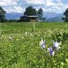
Steady climb or smooth and fast descent
Jul 13, 2013 near Vail, CO

0 Comments

Weather


Current Trail Conditions

Unknown
Add Your Check-In

Check-Ins

Jun 19, 2021
Joseph Rowe III
Oct 5, 2014
Jason Walence
This is just a forrest service road climb, its kinda blah. tough steep sections keep it solid intermediate though. 5mi
Welcome

Join the Community

Create your FREE account today!
Already have an account? Login to close this notice.

Get Started