
 Continue with onX Maps
 Continue with Facebook


 Very Difficult

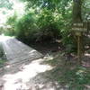
“A rocky old CCC-era trail with a technical descent. ”


2.0
Miles3.2
KMSingletrack
 Very Difficult
Local Club: SORBA - Huntsville
Land Manager: Alabama State Parks
 Blevins Gap Scenic Ride
4.0 mi 6.5 km • 450' Up 137.26 m Up • 449' Down 136.79 m Down


 Duck Weed Basin
4.5 mi 7.3 km • 20' Up 6.14 m Up • 20' Down 6.12 m Down
 Hays Nature Preserve
4.0 mi 6.5 km • 33' Up 9.97 m Up • 33' Down 9.99 m Down
 Tri for Ole Glory Route
4.2 mi 6.7 km • 161' Up 48.94 m Up • 162' Down 49.45 m Down
Tour de Lake Guntersville State Park
9.8 mi 15.7 km • 574' Up 174.89 m Up • 576' Down 175.69 m Down
 Lake Guntersville State Park - Figure 8
9.1 mi 14.7 km • 747' Up 227.75 m Up • 725' Down 220.94 m Down


0 Comments