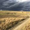
“Useful connector to link some of the paved bike paths and East Boulder trailheads with Marshall Mesa ”
3.4
Miles5.4
KMSingletrack

Local Club: Boulder Mountainbike Alliance
Feb 22, 2024: Join us in Shaping Colorado’s Outdoor Future
Feb 1, 2024: Eagle-Sage Trail Closures
Jan 31, 2024: Coalton Trail Reopening Feb. 1
Land Manager: City of Boulder, Colorado - Parks and Recreation
 Spring Brook Loop
12.6 mi 20.2 km • 943' Up 287.5 m Up • 943' Down 287.41 m Down


 Superior, CO
 Gunbarrel to Niwot: Cottontail Trail - Niwot Loop - LoBo Trail
15.9 mi 25.5 km • 496' Up 151.09 m Up • 567' Down 172.87 m Down


 Gunbarrel, CO
 North Boulder Loop
8.3 mi 13.4 km • 372' Up 113.47 m Up • 371' Down 113.22 m Down


 Boulder, CO
 Rock Creek Farm Loop
11.8 mi 18.9 km • 301' Up 91.78 m Up • 305' Down 93.04 m Down


 Broomfield, CO
 Woman Creek Loop
6.9 mi 11.1 km • 490' Up 149.29 m Up • 490' Down 149.28 m Down


 Superior, CO
 Sugarloaf to Gordon Gulch Loop
13.5 mi 21.7 km • 1,590' Up 484.64 m Up • 1,607' Down 489.88 m Down


 Boulder, CO


0 Comments