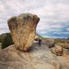
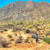
“A mile-long trail through some granite boulder filled terrain. ”
0.7
Miles1.2
KMSingletrack

Land Manager: City of Scottsdale
 Brown's Ranch Perimeter Loop
15.5 mi 24.9 km • 607' Up 185.12 m Up • 607' Down 185.13 m Down


 Carefree, AZ
 The Bell Toll
10.4 mi 16.7 km • 1,981' Up 603.93 m Up • 1,982' Down 603.97 m Down


 Fountai…, AZ
 TT & Windgate - Double Bypass
19.3 mi 31.1 km • 3,303' Up 1006.83 m Up • 3,303' Down 1006.84 m Down


 Fountai…, AZ
 Sonoran Desert Loop
13.4 mi 21.5 km • 1,112' Up 339.02 m Up • 1,110' Down 338.44 m Down


 Cave Creek, AZ
 Pemberton Loop
15.7 mi 25.3 km • 792' Up 241.53 m Up • 791' Down 241.09 m Down


 Rio Verde, AZ
 Figure 8
6.1 mi 9.8 km • 656' Up 200.02 m Up • 656' Down 199.89 m Down


 Anthem, AZ


0 Comments