Dogs Unknown

E-Bikes
Unknown
Features
Views
Overview
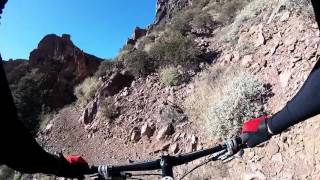
Starting with a long climb, this section of the Arizona Trail gives an eight-mile descent to the Gila River as a reward. Remote backcountry views abound as you go over the mountain passes. Then parallel the Gila River east to Kearny.
Need to Know
Picketpost Trail is open dawn to dusk. Park outside the main trailhead gate if you could return after sunset. There are lots of pull-outs along the road to the trailhead to park.
This is big and remote country so take plenty to drink, eat, and know how to repair your ride. There won't be cellphone coverage in most of the mountain areas. Water filter locations are seasonally available along the route.
Description
From Picketpost Mountain Trailhead, the trail follows the AZT - Passage 17 - Alamo Canyon to the south. It's a steady climb with a few rocky and off-camber sections.
Leaving Alamo Canyon about 11.5 miles into this ride, you'll transition to AZT - Passage 16 - Gila River Canyons. On your way, you'll contour upwards amid the saguaros with some smooth sections. The trail is very well designed and maintained, so almost everything is rideable. There is an AZT water collector just south of the trail near mile 12 before you descend into the valley. Follow the jeep road to get to it.
After looping around the second pass, enjoy the extended downhill to the Gila River. Shortly after turning at the river, you reach the lowest point on the AZT at 1,646 ft. as the trail turns east. There are some short sections of 4x4 over the next 10 miles before switching back to 100% singletrack.
A few significant climbs remain (smaller than the earlier starting push) as you finish the route paralleling the Gila river.
History & Background
About four miles from the finish, you'll pass the golden spike commemorating the last section of the Arizona Trail completion.
Shared By:
Jason Osborn

 Continue with onX Maps
 Sign in with Facebook


 Intermediate/Difficult

 4.3 (3)


0 Comments