
 Continue with onX Maps
 Continue with Facebook


 Intermediate

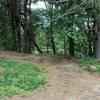
“The Midstate Trail runs through central Massachusetts from Ashburnham to Douglas. ”


91.1
Miles146.5
KMSingletrack
 Intermediate
 Beaver Brook Loop
8.1 mi 13.0 km • 554' Up 168.85 m Up • 572' Down 174.33 m Down

 Yudicky Loop
11.1 mi 17.9 km • 839' Up 255.69 m Up • 843' Down 257.06 m Down
 Russel Mill Tour
4.9 mi 7.9 km • 305' Up 93.08 m Up • 305' Down 92.89 m Down
Chelmsford, MA
Russel Mill - GBF Linkup
19.8 mi 31.9 km • 890' Up 271.15 m Up • 883' Down 269.2 m Down
Carlisle, MA
 Colton Road Conservation Area (AKA Rayburn Trails)
4.2 mi 6.8 km • 244' Up 74.47 m Up • 244' Down 74.28 m Down
Millbury, MA
Callahan Tour
9.4 mi 15.1 km • 773' Up 235.68 m Up • 774' Down 235.93 m Down


0 Comments