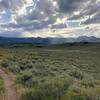
“Connector trail from Toll Creek to Road to WOS. ”
2.2
Miles3.5
KMSingletrack

Land Manager: Basin Recreation
 Flying Dog Connector Loop
13.5 mi 21.6 km • 1,828' Up 557.29 m Up • 1,831' Down 558.01 m Down


 Summit…, UT
 Dog Lake
5.9 mi 9.5 km • 1,218' Up 371.18 m Up • 1,215' Down 370.2 m Down


 Snyderv…, UT
 MidWeekMTB - Solitude Course 2
5.2 mi 8.4 km • 904' Up 275.5 m Up • 917' Down 279.39 m Down


 Alta, UT
 Mid Mountain Loop - IMBA EPIC
22.9 mi 36.8 km • 2,307' Up 703.06 m Up • 2,351' Down 716.44 m Down


 Park City, UT
 OG Park City IMBA Epic
32.8 mi 52.8 km • 4,138' Up 1261.34 m Up • 4,143' Down 1262.77 m Down


 Park City, UT
 Round Valley Loop
11.3 mi 18.2 km • 1,189' Up 362.43 m Up • 1,189' Down 362.32 m Down


 Park City, UT


0 Comments