Use onX Backcountry to explore the terrain in 3D, view recent satellite imagery, and more.
Now available in onX Backcountry Mobile apps!
For more information see this post.
Starting from the McCulloch road parking, follow KLO creek upwards on a well marked path. Various signs direct you towards the Angel Springs trail and identify mountain biking routes/points. Watch for descending bikers! About halfway up to the spring the forest changes to dry cedars which provide a very dark and cool canopy even on sunny hot days. After 6km one reaches the spring with two interpretive signs telling of the geologic significance and history of the trail/area.
Moderately steep. Uneven terrain with small rocks or roots.
Sizable rocks & roots. Steep sections.
Steep. Some technical terrain and limited alternate lines.
Very steep. Technical terrain with no alternate lines.
Difficulty Rating
Average from 1 vote:
Intermediate/Difficult
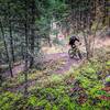
Your Rating
Virtual Tour of McCulloch Road to Angel Springs via KLO Creek
We use cookies to improve your browsing experience, to show you
personalized content, and for statistical purposes. By continuing
to navigate our website, you accept our use of cookies. Read our
Privacy Policy to learn more.
0 Comments