
 Continue with onX Maps
 Continue with Facebook


 Intermediate

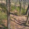
“Connects to White and Blue Trails for access to Cushetunk Ridge area. ”


0.8
Miles1.2
KMSingletrack
 Intermediate
Local Club: Jersey Off Road Bicycle Association
Feb 29, 2024: The Greenway Open House 3/14
Feb 29, 2024: The Palisades Shared Use Path Study
Feb 27, 2024: How to add a trail report on Trailforks
Land Manager: Hunterdon County Division of Parks & Recreation
 Round Valley Reservoir Loop
15.2 mi 24.4 km • 1,559' Up 475.31 m Up • 1,552' Down 473.18 m Down


 Stephens Backcountry Loop
7.0 mi 11.3 km • 823' Up 250.93 m Up • 823' Down 250.71 m Down
 Six Mile Run
13.8 mi 22.2 km • 268' Up 81.56 m Up • 269' Down 82.08 m Down
Middlebush, NJ
Frost Woods Park
5.2 mi 8.3 km • 245' Up 74.6 m Up • 245' Down 74.68 m Down


0 Comments