
 Continue with onX Maps
 Continue with Facebook


 Intermediate


2.8
Miles4.5
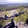
KMSingletrack
 Intermediate
Local Club: Black Hills Trails
Land Manager: USFS - Northern Hills Ranger District
 Centennial Trail-Bulldog Climb
8.2 mi 13.3 km • 885' Up 269.88 m Up • 885' Down 269.72 m Down
Sturgis, SD
 Hanson-Larsen Memorial Park Race Course
13.4 mi 21.5 km • 1,868' Up 569.38 m Up • 1,865' Down 568.55 m Down
Mickelson: Deadwood to Edgemont
113.3 mi 182.3 km • 4,096' Up 1248.55 m Up • 5,234' Down 1595.21 m Down
Mile High Challenge Course
23.7 mi 38.1 km • 1,862' Up 567.46 m Up • 1,577' Down 480.63 m Down
Lead, SD
Gold Rush Gravel Grinder
114.8 mi 184.7 km • 6,654' Up 2028.29 m Up • 6,648' Down 2026.37 m Down
Spearfish, SD
Dakota Five-O Course
51.7 mi 83.3 km • 5,999' Up 1828.45 m Up • 5,999' Down 1828.55 m Down
Spearfish, SD


0 Comments