
 Continue with onX Maps
 Continue with Facebook


 Intermediate


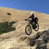
“Either the beginning of the ascent or the end of a descent of Loma Alta. ”


0.6
Miles0.9
KMDoubletrack
 Intermediate
Local Club: Marin County Bicycle Coalition
Land Manager: Marin County Parks
 Tamarancho to Repack
13.8 mi 22.2 km • 1,776' Up 541.39 m Up • 1,777' Down 541.66 m Down
 Repack via Deer Park Fireroad
12.8 mi 20.6 km • 1,622' Up 494.47 m Up • 1,618' Down 493.26 m Down
China Camp State Park Loop
8.7 mi 14.0 km • 772' Up 235.44 m Up • 772' Down 235.27 m Down
 Santa V…, CA
 To Tamarancho and Beyond (auto free)
30.4 mi 48.9 km • 4,394' Up 1339.17 m Up • 4,364' Down 1330.16 m Down
San Rafael, CA
 Easy Mt Tam: Mtn Home Inn to West Point Inn
8.5 mi 13.6 km • 873' Up 266.15 m Up • 866' Down 263.82 m Down
Tennessee Valley to Horseshoe Bay
8.6 mi 13.8 km • 1,145' Up 348.94 m Up • 1,343' Down 409.2 m Down


0 Comments