
 Continue with onX Maps
 Continue with Facebook


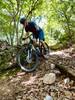
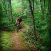
 Difficult

“A slow start that warms up to some enjoyable riding. ”


4.8
Miles7.7
KMSingletrack
 Difficult
Land Manager: USFS - Jefferson National Forest Clinch Ranger District
 Horse Heaven
14.0 mi 22.6 km • 2,561' Up 780.67 m Up • 2,562' Down 780.8 m Down


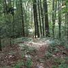
 Forest Trail
1.1 mi 1.7 km • 231' Up 70.34 m Up • 243' Down 74.12 m Down
Rural R…, VA
 Bikepacking Pulaski to Damascus
122.9 mi 197.8 km • 9,173' Up 2795.81 m Up • 9,179' Down 2797.78 m Down
Bear Creek to Crawfish Ride
13.2 mi 21.3 km • 838' Up 255.56 m Up • 843' Down 256.8 m Down
Westwood Park Red Loop
6.8 mi 10.9 km • 507' Up 154.42 m Up • 502' Down 152.93 m Down


0 Comments