
 Continue with onX Maps
 Continue with Facebook


 Intermediate


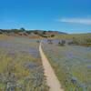
“A dirt fire road that can lead you further into the park or out. ”


1.0
Miles1.6
KMDoubletrack
 Intermediate
Land Manager: Monterey County - Parks
 Pipeline Loop
9.3 mi 14.9 km • 1,616' Up 492.63 m Up • 1,616' Down 492.47 m Down
 Salinas, CA
 Creekside Ride to Outhouse and back via Goat.
12.9 mi 20.8 km • 1,444' Up 440.04 m Up • 1,432' Down 436.57 m Down
Salinas, CA
Best of Ord - Short
17.9 mi 28.8 km • 2,176' Up 663.12 m Up • 2,177' Down 663.56 m Down
Salinas, CA
2020 Sea Otter Cross Country - Category 1
29.4 mi 47.4 km • 3,419' Up 1042.14 m Up • 3,412' Down 1039.86 m Down
Del Rey…, CA
 Inter-Garrison Rd to Kyle's Bench loop.
8.7 mi 14.0 km • 468' Up 142.59 m Up • 486' Down 148.13 m Down
Road Runner to Razorback
5.2 mi 8.4 km • 702' Up 213.88 m Up • 702' Down 214.09 m Down


0 Comments