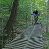
“A technical trail that will challenge you on both the ups and downs. ”
1.2
Miles2.0
KMSingletrack

Local Club: Millstone Trails Association
Land Manager: Millstone Trails Association
 Millstone Hill - West Side Rides
7.0 mi 11.3 km • 1,047' Up 318.98 m Up • 1,051' Down 320.37 m Down


 South B…, VT
 Norwich University Full Loop
3.7 mi 5.9 km • 802' Up 244.38 m Up • 807' Down 245.85 m Down


 Northfield, VT
 Northfield Intermediate Loop
2.6 mi 4.2 km • 465' Up 141.61 m Up • 466' Down 141.9 m Down


 Northfield, VT
 Peacham Groton Loop
13.8 mi 22.3 km • 1,314' Up 400.48 m Up • 1,313' Down 400.09 m Down


 Hardwick, VT
 Blueberry Lake Loop
4.2 mi 6.8 km • 475' Up 144.86 m Up • 475' Down 144.74 m Down


 Warren, VT
 Cady Hill Forest Expert's Loop
6.6 mi 10.6 km • 863' Up 262.94 m Up • 839' Down 255.71 m Down


 Stowe, VT


0 Comments