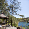
“The easy way to climb up to the top of the Tanasi Trail System. ”
3.0
Miles4.8
KMDoubletrack

Land Manager: USFS - Cherokee National Forest Office
 Mountaintown Creek Loop
20.4 mi 32.8 km • 2,935' Up 894.73 m Up • 2,938' Down 895.4 m Down


 Ellijay, GA
 Cohutta Springs Ride
4.9 mi 7.8 km • 574' Up 175.03 m Up • 573' Down 174.57 m Down


 Chatsworth, GA
 Brutal Loop 2
34.7 mi 55.9 km • 4,514' Up 1375.88 m Up • 4,517' Down 1376.73 m Down


 Chatsworth, GA
 Singlespeed Smackdown 2018
36.3 mi 58.5 km • 6,685' Up 2037.49 m Up • 6,656' Down 2028.78 m Down


 Chatsworth, GA
 Singlespeed Smackdown Deuce 2019
39.7 mi 64.0 km • 5,456' Up 1662.95 m Up • 5,467' Down 1666.36 m Down


 Chatsworth, GA
 Stanley Gap Loop
14.4 mi 23.2 km • 2,072' Up 631.45 m Up • 2,061' Down 628.27 m Down


 Blue Ridge, GA


0 Comments