
 Continue with onX Maps
 Continue with Facebook


 Intermediate

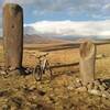
“A steady dirt road climb to a lake shore and a collection of Vishapakars. ”


8.3
Miles13.4
KMDoubletrack
 Intermediate
 Geghard Monastery - Garni Temple Route
17.6 mi 28.3 km • 2,039' Up 621.6 m Up • 3,142' Down 957.8 m Down
 Goght’, AM
Geghard Monastery to Khosrov Reserve and Temple of Garni Ride
Goght’, AM
Geghard Monastery to Khosrov Reserve and Temple of Garni Ride
21.3 mi 34.3 km • 2,612' Up 796.04 m Up • 3,732' Down 1137.53 m Down
Goght’, Not set (Republic of Armenia)
Geghard Monastery to Vishapakars and Temple of Garni Ride
28.0 mi 45.0 km • 3,742' Up 1140.41 m Up • 4,856' Down 1479.98 m Down
Goght’, Not set (Republic of Armenia)
Narek to Dvin Ride
29.8 mi 47.9 km • 4,530' Up 1380.68 m Up • 4,734' Down 1442.85 m Down
Verin A…, Not set (Republic of Armenia)
Stone Lake Ride
33.2 mi 53.4 km • 5,287' Up 1611.53 m Up • 5,696' Down 1736.02 m Down
Ushi, Not set (Republic of Armenia)
 Aparan Water Reservoir to Arthur's Resort Ride
14.7 mi 23.7 km • 2,553' Up 778.02 m Up • 2,261' Down 689.26 m Down
Shenavan, Not set (Republic of Armenia)


0 Comments