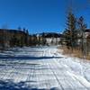
“An alternate route to the Blue Dot Trail (#606.1) that travels around a hill. ”
0.5
Miles0.9
KMSingletrack

 Rhythm & Blues
10.3 mi 16.6 km • 825' Up 251.57 m Up • 825' Down 251.49 m Down


 Nederland, CO
 West Magnolia: Winter Fat Bike Groomed Loop
4.6 mi 7.4 km • 253' Up 77.21 m Up • 255' Down 77.66 m Down


 Nederland, CO
 East Mag Dots
13.8 mi 22.2 km • 1,075' Up 327.67 m Up • 1,074' Down 327.27 m Down


 Nederland, CO
 Switzerland Trail Gold Hill Road Loop
25.3 mi 40.7 km • 1,949' Up 593.94 m Up • 1,948' Down 593.78 m Down


 Nederland, CO
 Sugarloaf to Gordon Gulch Loop
13.5 mi 21.7 km • 1,590' Up 484.64 m Up • 1,607' Down 489.88 m Down


 Boulder, CO
 The Whole Casino
16.9 mi 27.1 km • 2,451' Up 746.95 m Up • 2,447' Down 745.8 m Down


 Central…, CO


0 Comments