MTB Project Logo

A beautiful canyon in the middle of El Paso, with challenging climbs and amazing technical downhills.


Your Rating: Rating Rating Rating Rating Rating      Clear Rating
Your Difficulty:
Your Favorites: Add To-Do · Your List
Zoom in to see details
Map Key

4.8

Miles

7.8

KM

75%

Singletrack

4,613' 1,406 m

High

4,128' 1,258 m

Low

894' 273 m

Up

894' 273 m

Down

7%

Avg Grade (4°)

29%

Max Grade (16°)

Dogs Leashed

E-Bikes Unknown

Family Friendly The Palisades Canyon Access Road and Jeep trails on this loop are kid friendly and away from the thorniest sections.

-The northernmost part of this loop is technically within the Franklin Mt State Park but there are no pay stations.
-Hours: 6am to 10pm
-No Private Motorized Vehicles
-No Fires
-No Alcohol
-No Destruction or Removal of Plants or Rocks
-No Littering
-Pets Must be on a Leash
-Pet Owners Must Pick up Animal Waste

Overview

Palisade Canyon is centrally located in El Paso, TX on over 200 acres and provides challenging and varied terrain. The Palisades Canyon Access Road on the southwestern part of the loop can be ridden by beginners though is quite steep at times. The northern and eastern portions provide challenging technical switchbacks, climbing, and descents more suited for intermediate to advanced riders.

Need to Know

There is some parking near the trailhead at the base of Scenic Drive. You can also park at the El Paso Tennis Club and ride up through Arroyo Park as a warm-up. Great restaurants, bars, and a couple of bike shops are about a quarter mile west on Mesa St.

Scenic Drive begins near the trailhead and provides a scenic overlook of the City of El Paso and the neighboring city of Juarez, Chihuahua in Mexico.

Description

The Palisade Canyon Loop begins just north of Arroyo Park on Robinson Ave. The trailhead must be accessed by taking Rim Road to Robinson as the Mesa St access route is under construction.

A dirt road climb, the Palisades Canyon Access Road, awaits you at the start of the trail. After turning left at the top of the road where things turn rocky, you'll be greeted by a super tough doubletrack climb over some jagged rock sections. A series of challenging, technical climbs and descents follow and you are guaranteed to have to hike a few short sections up that are even tough off the bike.

The downhill rewards are well worth it and some long, solid rock sections will remind you of Moab, Utah, especially, the section of Ana's Trail that is part of this loop. Near the northernmost part of the western half, you'll be treated to some fast technical switchbacks and a dizzying view that are part of the Vertigo Ridge trail.

The second half is mostly downhill after a short low-grade doubletrack climb on part of the Thousand Steps Trail and you'll be challenged by rough and loose sections along with more solid rock sections where you'll be dodging boulders two feet tall at times as you descend on Monk's Trail. A high suspension travel all mountain rig is better for the downhill sections of this loop. XC bikes will take a serious beating...if you can keep from going over the bars.

Near the end, you'll encounter some fun, technical switchbacks and a few jumps with very narrow landings that require great precision. Luckily, you can ride over these and treat them more like a pump track section. After the jump section, put your bike in a high gear and pedal like mad to make it up the steep ramp to the Palisades Canyon Access Road you started on!

At the end of the loop, you can do a short cool down in Arroyo Park to help bring your adrenaline levels back to normal...unless you ride all the way down to the jump line in Arroyo Park that is.

History & Background

The canyon sits on 200 acres and is crisscrossed with old mining roads, the northern trails of this canyon beckon the more seasoned riders with moderate to difficult biking and hiking routes. The City of El Paso purchased the land from a developer who had planned to build a new residential subdivision in the area, and thus preserving it for public use.

Contacts

Shared By:

Tony Reyes

Trail Ratings

  3.7 from 13 votes

#2468

Overall
  3.7 from 13 votes
5 Star
23%
4 Star
46%
3 Star
15%
2 Star
8%
1 Star
8%
Recommended Route Rankings

#80

in Texas

#2,468

Overall
18 Views Last Month
2,891 Since Sep 30, 2017
Difficult Difficult

0%
0%
10%
0%
90%
0%

Photos

Heading south near the start of Ana's Trail.
Jan 5, 2023 near El Paso, TX
Nearing the water tank, fun, technical sweeping switchbacks.
Oct 1, 2017 near El Paso, TX
Solid rock sections give you a taste of Moab.
Sep 30, 2017 near El Paso, TX
Another challenging short climb.  Hike it if you have to, the downhills are worth it.
Oct 1, 2017 near El Paso, TX
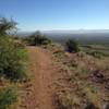
Overlooking canyon.
Oct 15, 2020 near El Paso, TX
You'll likely be hiking up some of the steepest sections, luckily they are short.
Oct 1, 2017 near El Paso, TX
loading

Weather


Current Trail Conditions

Unknown
Add Your Check-In

Check-Ins

Mar 8, 2023
The Great Dan Millis
This is a terrible route full of babyheads hike-a-bike no fun!
May 21, 2021
Lost Justpastnowhere
Apr 10, 2018
Saul Sosa
Welcome

Join the Community

Create your FREE account today!
Already have an account? Login to close this notice.

Get Started