
 Continue with onX Maps
 Continue with Facebook


 Intermediate


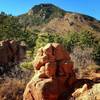
“A forest service road from Carroll Lakes Road (312) to Beaver Creek Road (315) ”


2.6
Miles4.2
KMDoubletrack
 Intermediate
Land Manager: USFS - Pikes Peak Ranger District
 Blodgett Fun
11.8 mi 19.0 km • 2,496' Up 760.65 m Up • 2,509' Down 764.6 m Down
 Double Stuffed
22.2 mi 35.7 km • 1,694' Up 516.48 m Up • 5,103' Down 1555.36 m Down
 Cascade…, CO
Pikes Peak Plummet
Cascade…, CO
Pikes Peak Plummet
26.2 mi 42.1 km • 937' Up 285.51 m Up • 6,529' Down 1990.02 m Down
Cascade…, CO
D-Loop #2.2
7.8 mi 12.5 km • 763' Up 232.57 m Up • 786' Down 239.58 m Down
Air For…, CO
Ring the Peak 2019
66.8 mi 107.5 km • 10,373' Up 3161.56 m Up • 10,373' Down 3161.84 m Down
Manitou…, CO
 Ute Valley Six Mile Loop
5.8 mi 9.3 km • 578' Up 176.04 m Up • 579' Down 176.35 m Down
Colorad…, CO


0 Comments