MTB Project Logo

A scenic two-track along the Idaho / Montana state line and the crest of the Continent.


Your Rating: Rating Rating Rating Rating Rating      Clear Rating
Your Difficulty:
Your Favorites: Add To-Do · Your List
Zoom in to see details
Map Key

14.1

Miles

22.7

KM

Doubletrack

9,469' 2,886 m

High

7,372' 2,247 m

Low

1,485' 453 m

Up

3,084' 940 m

Down

6%

Avg Grade (4°)

28%

Max Grade (16°)

Dogs Off-leash

E-Bikes Unknown

Description

The CDT between the east flank of Goat Mountain and Lemhi Pass is two-track. The road pretty much follows exactly the crest of the divide. There are wide open alpine meadows separated by timbered sections. The CDT can be flat and easy or very steep up/down; expect some hike-a-bike on the steeps. The road loses a lot of elevation as it nears Lemhi Pass.

Access to water sources are signed along the trail.

Contacts

Shared By:

David Lingle

Trail Ratings

  3.0 from 1 vote

#27368

Overall
  3.0 from 1 vote
5 Star
0%
4 Star
0%
3 Star
100%
2 Star
0%
1 Star
0%
Trail Rankings

#1,068

in Montana

#27,368

Overall
1 Views Last Month
173 Since Apr 24, 2017
Intermediate Intermediate

0%
0%
100%
0%
0%
0%

Photos

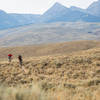
Continental Divide doubletrack near Peterson Creek.
Apr 20, 2017 near Salmon, ID

0 Comments

Weather


Current Trail Conditions

Unknown
Add Your Check-In

Check-Ins

none
Welcome

Join the Community

Create your FREE account today!
Already have an account? Login to close this notice.

Get Started