The general rule of thumb for the Lefthand OHV Area (LHOHV) is to climb the roads and descend the singletrack. Regardless, even the dirt road climbing can be miserable here.
If the Entrance Trail is any indication, you'll notice that the trails and roads here were not developed with mountain bikes in mind. To say that there is no "flow" here is an understatement. Save for a few spots of respite, you're either heading what feels like straight uphill, or the opposite. This area doesn't do middle ground very well...
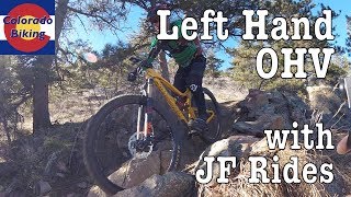
If you're hearty enough to handle the loose, relentless rocks, dirt, and steep grades you can learn to love this extremely technical trail system. Bring your big bike, a couple of buddies in case you break yourself, and a healthy attitude towards suffering.
From the Buckingham Park trailhead, head west on Lefthand Canyon Drive. Just before the road peels left at a 90°, look for the singletrack entrance to this system. The Entrance Trail climbs very steeply until it reaches a bench that contours south, generally following Lefthand Canyon Drive. Take pleasure in looking down upon the roadies that waddle beneath you in their spandex, but don't throw anything at them; they've still got a lot of road to cover.
From Entrance Trail, turn left onto this trail system's main thoroughfare,
Road #286. The road climbs gradually, switchbacking multiple times along the way. Eventually, it reaches a ridgeline and the five points intersection. Continue following the signs for
Road #286 and prepare for one of the steepest sections of this ride...
Like any good motorized trail or road,
Road #286 grinds upwards at a heart attack inducing grade (>14%). To boot, the road is of course strewn with loose babyhead rocks that you simply cannot avoid. Once at the top, you'll reach an intersection with
Road #287B. Turn left here and enjoy the first downhill of the route.
Road #287B contours south, gradually descending to another intersection. Along the way, have fun picking your way through the rocks and loose dirt. Eventually, the road enters a break in the trees where two singletracks dart off from;
Bon Scott Trail #845 and Wilitz's Trail Spur #843A.
You're smart, so you're going to take
Bon Scott Trail #845. This absolutely rowdy DH starts mellow and becomes more extreme the further it goes. The start is very fast and the entirety of the trail is loose, so keep your wits about you. One of the more technical trails in Boulder, this trail is also very committing. If you are unsure about your ability to clear some of the moves, it's safer to walk.
Like a good yoga workout, the trail's tech finishes near its terminus and it offers up a nice cool-down in the form of a few well-bermed switchbacks. The end of
Bon Scott Trail #845 spits you out onto what could have been an old sluice or flume grade. Stay left here and you'll reach
#286 - #845 Connector.
#286 - #845 Connector will take you back to your favorite friend,
Road #286! Take that uphill (again) to the five points intersection I mentioned earlier. Here, instead of continuing up
Road #286, turn right onto
Road #286D. Like the other roads in this area, it's steep, loose, and hard. Locally, this section is known as "Fireman Hill".
In the middle of one of the switchbacks on the road, you'll hit an intersection with
Saddle Trail West #841. Take this trail as it contours you east, towards even sweeter terrain. Sure,
Saddle Trail West #841 has a few moves that are very technical and won't be rideable for most people (especially some rocky/rooty step-ups), but it's pretty fun for the most part and the views are great.
After one last downhill rock garden, the trail ends at an intersection with its sister trail,
Saddle Trail East #842. I normally don't like to play favorites, but if I did,
Saddle Trail East #842 would be my #1 choice... The trail whips east heading through open grassland land burned in the Lefthand Fire and this stark landscape provides the perfect backdrop to the fun on this trail.
As it descends,
Saddle Trail East #842 works its way into more dense forest, all the while providing riders with multiple technical spots; all of which are rideable. As the trees thicken, the grade steepens. From here, the trail provides a straight shot to its terminus, but not without throwing a few more rock gardens your way.
From the end of
Saddle Trail East #842, turn left back onto the Entrance Trail which will drop you back onto Lefthand Canyon Drive.
This trail system has experienced elemental damage not seen by most other areas in the region. Not only was this zone a victim of the Lefthand Fire (2011), it also suffered great damage during the Boulder Flood (2013).
Regardless of the environmental impacts this area has undergone and the sorry shape some of the trails might be in, you can be thankful to moto riders that these trails exist in the first place. These trails were built by moto riders, for motos and please do not forget that. So, next time you see a local moto rider, instead of scoffing at them because their brapping is too loud, maybe you should thank them for making this small trail system possible.

 Continue with onX Maps
 Sign in with Facebook


 Difficult


 Heil Ranch
 Chapman Drive Out-And-Back
 Hall Ranch
 Ceran St. Vrain to Miller Rock


7 Comments