
 Continue with onX Maps
 Continue with Facebook


 Difficult

“A tougher, longer offering of singletrack at the Coyote Wall/Syncline Trail System. ”


2.0
Miles3.1
KMSingletrack
 Difficult
Land Manager: USFS - Gifford Pinchot National Forest Office
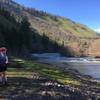
 Klickitat River Trail
31.3 mi 50.5 km • 1,504' Up 458.37 m Up • 96' Down 29.14 m Down


 Post Canyon Hot Lap
9.6 mi 15.5 km • 1,294' Up 394.45 m Up • 1,286' Down 392.09 m Down
Hood River, OR
 Sexy Surfer Loop
7.9 mi 12.6 km • 1,158' Up 352.92 m Up • 1,157' Down 352.6 m Down
Post Shuttle to Hot Lap
9.3 mi 15.0 km • 403' Up 122.76 m Up • 2,835' Down 864.04 m Down
Odell, OR
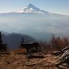
Surveyor's Ridge - IMBA EPIC
20.4 mi 32.9 km • 3,133' Up 955.01 m Up • 3,506' Down 1068.72 m Down
 Knebal Springs Loop
9.4 mi 15.2 km • 1,732' Up 527.92 m Up • 1,732' Down 527.99 m Down


1 Comment