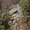
“A steep to steady descent on the east side of Milford Gap ”
2.6
Miles4.1
KMSingletrack

Land Manager: USFS - George Washington & Jefferson National Forests
 Seven Bends State Park with Woodstock South Ridge
12.9 mi 20.8 km • 1,996' Up 608.5 m Up • 1,991' Down 606.91 m Down


 Woodstock, VA
 Signal Knob - Meneka Peak - Bear Wallow Loop
8.7 mi 14.1 km • 1,752' Up 533.86 m Up • 1,746' Down 532.32 m Down


 Strasburg, VA
 Elizabeth Furnace - Figure 8 of Hate
24.4 mi 39.2 km • 2,975' Up 906.74 m Up • 2,972' Down 905.87 m Down


 Strasburg, VA
 Little Schloss Loop
7.0 mi 11.3 km • 1,154' Up 351.78 m Up • 1,140' Down 347.61 m Down


 Woodstock, VA
 Big Schloss Loop
9.6 mi 15.5 km • 1,658' Up 505.41 m Up • 1,644' Down 501.16 m Down


 Woodstock, VA
 Bird Knob and Catherine Furnace Loop
20.2 mi 32.5 km • 3,580' Up 1091.13 m Up • 3,581' Down 1091.51 m Down


 New Market, VA


1 Comment