MTB Project Logo

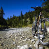
A solitary forest road through a remote valley between two mountain ranges.


Your Rating: Rating Rating Rating Rating Rating      Clear Rating
Your Difficulty:
Your Favorites: Add To-Do · Your List
Zoom in to see details
Map Key

7.8

Miles

12.6

KM

Doubletrack

5,215' 1,589 m

High

4,059' 1,237 m

Low

352' 107 m

Up

1,239' 378 m

Down

4%

Avg Grade (2°)

22%

Max Grade (12°)

Dogs Unknown

E-Bikes Unknown

Description

This is a gravel forest road that runs first through the Gaistal Valley and then continues into the Leutaschtal Valley.

From the Ehrwalder Alm, it climbs for about one mile. Just after you begin the downhill section through the Gaistal valley, you'll pass by a small lake, the Igelsee (Eagle Lake). Then you'll enjoy seven miles of nearly continuous descent to the Parkplatz Salzbach (Salt Creek Parking Area) where this trail connects with the Leutascher Ache Bike Trail and a further 10 miles of near continuous descent.

This trail goes through a picturesque valley offering plenty of solitude between the Wetterstein Mountains (to the north) and the Mieminger Kette Mountains (to the south). The views are definitely the highlight of this trail.

Shared By:

Lost Justpastnowhere

Trail Ratings

  4.0 from 1 vote

#16057

Overall
  4.0 from 1 vote
5 Star
0%
4 Star
100%
3 Star
0%
2 Star
0%
1 Star
0%
Trail Rankings

#12

in Austria

#16,057

Overall
1 Views Last Month
120 Since Jan 23, 2017
Intermediate Intermediate

0%
0%
100%
0%
0%
0%

Photos

Stopping for a moment to enjoy the views and the solitude on the 17-mile descent along the Gaistalbach stream.
Nov 17, 2016 near Wilderm…, AT

0 Comments

Current Trail Conditions

Unknown
Add Your Check-In

Check-Ins

Sep 26, 2014
Lost Justpastnowhere
Welcome

Join the Community

Create your FREE account today!
Already have an account? Login to close this notice.

Get Started