Use onX Backcountry to explore the terrain in 3D, view recent satellite imagery, and more.
Now available in onX Backcountry Mobile apps!
For more information see this post.
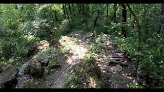
What goes down, must climb back up :) This trail features a fairly mellow descent before it reaches the bottom of the ravine to start a mild climb out. Taken in the direction mapped, you'll have maximum descent, and minimum climb back out.

 Continue with onX Maps
 Sign in with Facebook


 Intermediate


0 Comments