MTB Project Logo

A steep, road-trace descent with nice views and just a touch of exposure.


Your Rating: Rating Rating Rating Rating Rating      Clear Rating
Your Difficulty:
Your Favorites: Add To-Do · Your List
Zoom in to see details
Map Key

3.2

Miles

5.2

KM

Doubletrack

8,575' 2,614 m

High

7,430' 2,265 m

Low

51' 15 m

Up

1,146' 349 m

Down

7%

Avg Grade (4°)

28%

Max Grade (15°)

Dogs Unknown

E-Bikes Unknown

• There is no source of water on this ride. Carry plenty of water for each member of your party.
• This is a multi-use trail that is open to pedestrians, mountain bikers, equestrian users, and motorized traffic.
• Conditions change rapidly with weather events and during spring runoff. Check with the Monticello Ranger District for updated information.

Please Respect and Protect archaeological sites and report looting and vandalism: 1 800 722 3998

Description

The Gooseberry Trail (445) connects from the East Gooseberry Road (094) down to the South Cottonwood Road (106) over the course of three miles. The rocky road-trace adds up to a lot of braking due to prolonged steep sections.

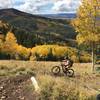
From the top, look for the faint road-trace off of East Gooseberry Road (094). The trail heads southeast along a gradual climb through scattered trees. After less than half-a-mile of riding, the trail begins to descend as the grand vista of the adjacent valley comes into view.

Soon, the rocky doubletrack comes alongside an eroded slope. At no point does the trail get too close to the edge, but curious riders may want to venture out for a better view. The steeper descent continues over the next few miles and many of the views are once again hidden.

Eventually, the grade mellows out near a low meadow, followed by a series of switchbacks. As the trail continues, it turns north and maintains a gradual descent until it connects with South Cottonwood Road (106).

Shared By:

Eric Ashley

Trail Ratings

  2.0 from 1 vote

#36441

Overall
  2.0 from 1 vote
5 Star
0%
4 Star
0%
3 Star
0%
2 Star
100%
1 Star
0%
Trail Rankings

#1,377

in Utah

#36,441

Overall
1 Views Last Month
178 Since Oct 24, 2016
Intermediate/Difficult Intermediate/Difficult

0%
0%
50%
0%
50%
0%

0 Comments

Weather


Current Trail Conditions

Unknown
Add Your Check-In

Check-Ins

none
Welcome

Join the Community

Create your FREE account today!
Already have an account? Login to close this notice.

Get Started